

By Dhruva Rajan, VP, Product at SatSure
On July 8, Google announced — in a support-forum notice, of all places — that Google Earth Pro’s desktop application will no longer be available for download after June 25, 2027. Installed copies will keep running, but from now on there are no updates, no bug fixes, and no security patches. On Macs, the end will likely come sooner: there is no Apple-silicon build, so the app dies with Rosetta.
I’ve worked in geospatial for over two decades — at Esri, then building GeoSpoc for eight years, and now at SatSure. So let me say something first that vendors in my position rarely say: Google Earth Pro was a phenomenal piece of software. It made the planet browsable. It put satellite imagery in front of millions of engineers, planners, and field teams who would never have opened a GIS. An entire generation of infrastructure professionals learned to think spatially inside that app. It deserves a respectful farewell.
But respect shouldn’t stop us from being honest about what happens next.
The quiet dependency
Across transmission utilities, DISCOMs, and pipeline operators I meet, Earth Pro is rarely on any approved-software register. Yet it is everywhere: KMZ files of proposed routes passed between planning teams; right-of-way walkdowns prepared on desktop overlays; encroachment disputes argued with screenshots of historical imagery; tower siting sanity-checked against elevation profiles. None of this was ever the tool’s job. It became the job because the tool was free, and free tools don’t go through procurement — they go through habit.
That habit now has an expiry date. From this month, every one of those workflows runs on software that will never be patched again. Your IT security team will eventually flag it. New engineers joining after June 2027 won’t be able to install it at all. And the web version Google points to as a replacement has import limits and stripped-down measurement tools that professional users have already, loudly, found wanting.
Even at its best, Earth Pro gave infrastructure teams pictures, not intelligence. The imagery carried no guarantee of currency — the basemap over your corridor might be six months old or six years old. There was no change detection, no alerting, no analytics. And when something went wrong — an outage traced to a tree that had been growing into a clearance zone for three seasons, an encroachment that pre-dated the last imagery refresh — the audit trail consisted of whatever screenshots someone remembered to save.
“Which data did you base that decision on?” is a question regulators, insurers, and courts are asking infrastructure operators with increasing frequency. “A free desktop app, imagery date unknown” was always a weak answer. After June 2027, it becomes an indefensible one.
What ‘after Earth Pro’ should look like
The mistake I expect many teams to make over the next twelve months is searching for another free viewer — recreating the same dependency with a different logo, and repeating this cycle in a few years. The better move is to recognize that each Earth Pro habit was a placeholder for an operational capability, and migrate accordingly.
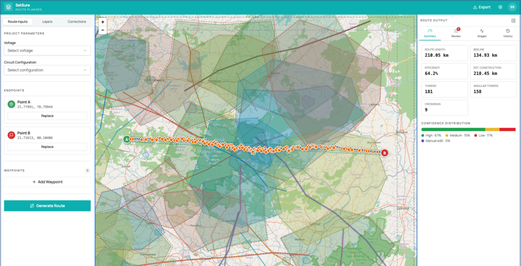
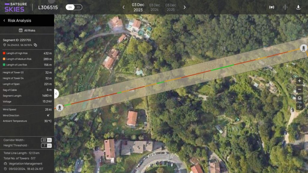
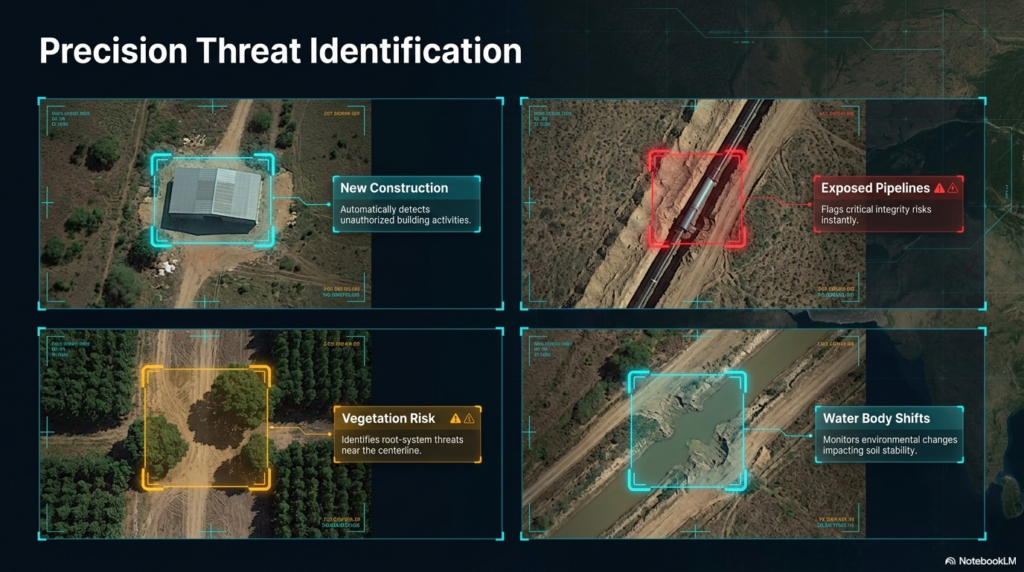
Route planning done by eyeballing terrain becomes AI-assisted route optimization that weighs land use, slope, settlements, and compliance corridors in hours instead of months. Right-of-way patrols planned on static overlays become risk-ranked vegetation management, where every span along the corridor is classified by encroachment risk and crews are dispatched to the spans that matter, not marched down the whole line. Periodic encroachment eyeballing becomes continuous change detection, where new construction, exposed pipe, or third-party activity near the asset triggers an alert instead of waiting for the next patrol. And screenshots-as-evidence become dated, auditable imagery archives you can actually put in front of a regulator.
A twelve-month runway, if you use it
Operators have until June 2027 before downloads disappear — and rather less than that before unpatched software becomes an audit finding. Twelve months is comfortable if you start now and brutal if you start in the final quarter. The migration itself is simpler than most teams expect: the KMZ and KML files your teams have accumulated for years are portable, and mapping each Earth Pro habit to its operational replacement is a workshop, not a project.
My suggestion is straightforward. This quarter, inventory where Earth Pro actually lives in your organization — you will find more of it than you expect. Next quarter, pick your highest-risk workflow — for most transmission operators that’s vegetation and ROW; for pipeline operators, third-party encroachment — and migrate it first. Let the remaining workflows follow the proof, not the deadline.
Google Earth Pro taught our industry to see from above. The operators who thrive after it are the ones who graduate from seeing to knowing — from a free window on the planet to an accountable system of record for every corridor they run.
The window closes June 25, 2027. The better question is what you’ll have built by then.
Dhruva Rajan is the VP, Product at SatSure, which delivers satellite-powered decision intelligence for utilities, pipelines, and critical infrastructure. He previously founded GeoSpoc, one of India’s leading geospatial services companies. SatSure offers migration assessments for teams moving off Google Earth Pro.